
Reality Capture to BIM
in Construction Projects
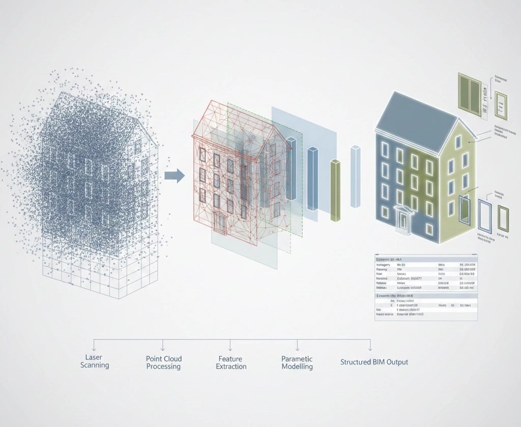
Reality Capture to BIM services involve converting captured site data into structured BIM models that accurately represent existing physical conditions. This process connects on-site data capture technologies with BIM workflows, enabling reliable digital representation of buildings, structures, and services based on verified spatial information.
The service is widely used on refurbishment, retrofit, brownfield, and operational projects where dependable digital models are required to support design development, coordination, and construction planning.
What Reality Capture to BIM Represents
Reality Capture to BIM represents the translation of physical site conditions into usable BIM geometry. Captured data, such as point clouds or photogrammetry outputs, is interpreted and modelled to reflect actual geometry, spatial relationships, and installed elements present on site.
The resulting BIM models provide a trustworthy digital reference that supports informed decision-making and reduces reliance on assumptions during downstream project stages.
When Reality Capture to BIM Services Are Required
Reality Capture to BIM services are typically required when projects involve existing facilities with limited or outdated documentation. They are commonly applied in refurbishment and upgrade projects where new works must integrate accurately with existing building elements and services.
This service is also engaged when precise spatial understanding is required prior to design development, coordination, or construction activities, particularly in complex or service-dense environments.
Project Types That Use Reality Capture to BIM
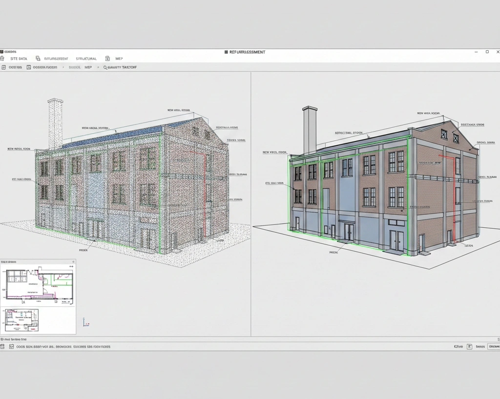
Reality Capture to BIM is applied across commercial, industrial, healthcare, education, and residential projects. It is particularly valuable in operational facilities, plant rooms, risers, ceiling voids, and technical areas where accurate representation of existing conditions directly impacts coordination outcomes.
The service supports both large-scale developments and smaller projects requiring high confidence in existing condition data.
Integration With BIM and Coordination Workflows
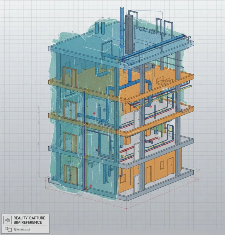
Reality Capture to BIM models are developed within BIM environments to support coordination, documentation, and design workflows. These models may be used as coordination bases, reference files, or starting points for further modelling and design development.
By grounding BIM workflows in captured site data, coordination activities are aligned with real-world conditions, reducing clashes, rework, and coordination uncertainty.
Accuracy, Standards and Model Development
Reality Capture to BIM outputs are developed to align with project-specific accuracy requirements and BIM standards. Model detail and accuracy levels are defined based on intended use, whether for coordination, documentation, refurbishment planning, or asset reference.
Models are delivered in formats compatible with BIM and CAD platforms, allowing efficient reuse across multiple project workflows.
Relationship With 3D Scanning, Scan to BIM and As-Built Modelling
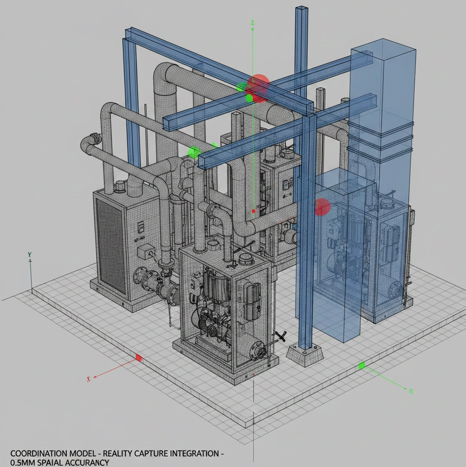
Reality Capture to BIM services are closely connected with 3D scanning, Scan to BIM, and as-built modelling workflows. Reality capture provides the source data, while BIM modelling processes convert this data into structured digital models.
These models may subsequently support as-built documentation, coordination validation, refurbishment planning, and long-term asset documentation.
Project Requirements & Next Steps
Reality Capture to BIM services are engaged when reliable digital representation of existing conditions is required to support modelling, coordination, or documentation workflows. Where accurate site-verified information is essential for project planning and execution, this service provides a structured and dependable approach.
What is reality capture to BIM?
Reality capture to BIM converts real-world data from laser scanning or photogrammetry into accurate BIM models.
When is reality capture required?
When existing site conditions must be documented accurately for refurbishment, retrofit, or coordination purposes.
How does reality capture improve BIM accuracy?
It ensures models reflect actual site geometry instead of assumptions or outdated drawings.
What outputs are delivered in reality capture projects?
Point clouds, BIM models, and coordinated digital documentation.
Can reality capture data be reused for future projects?
Yes, they support fabrication-ready and construction-ready documentation workflows.
Reality Capture to BIM Services - FAQs
Contact